Resource map
Resource Map: Phoenix and Nationwide
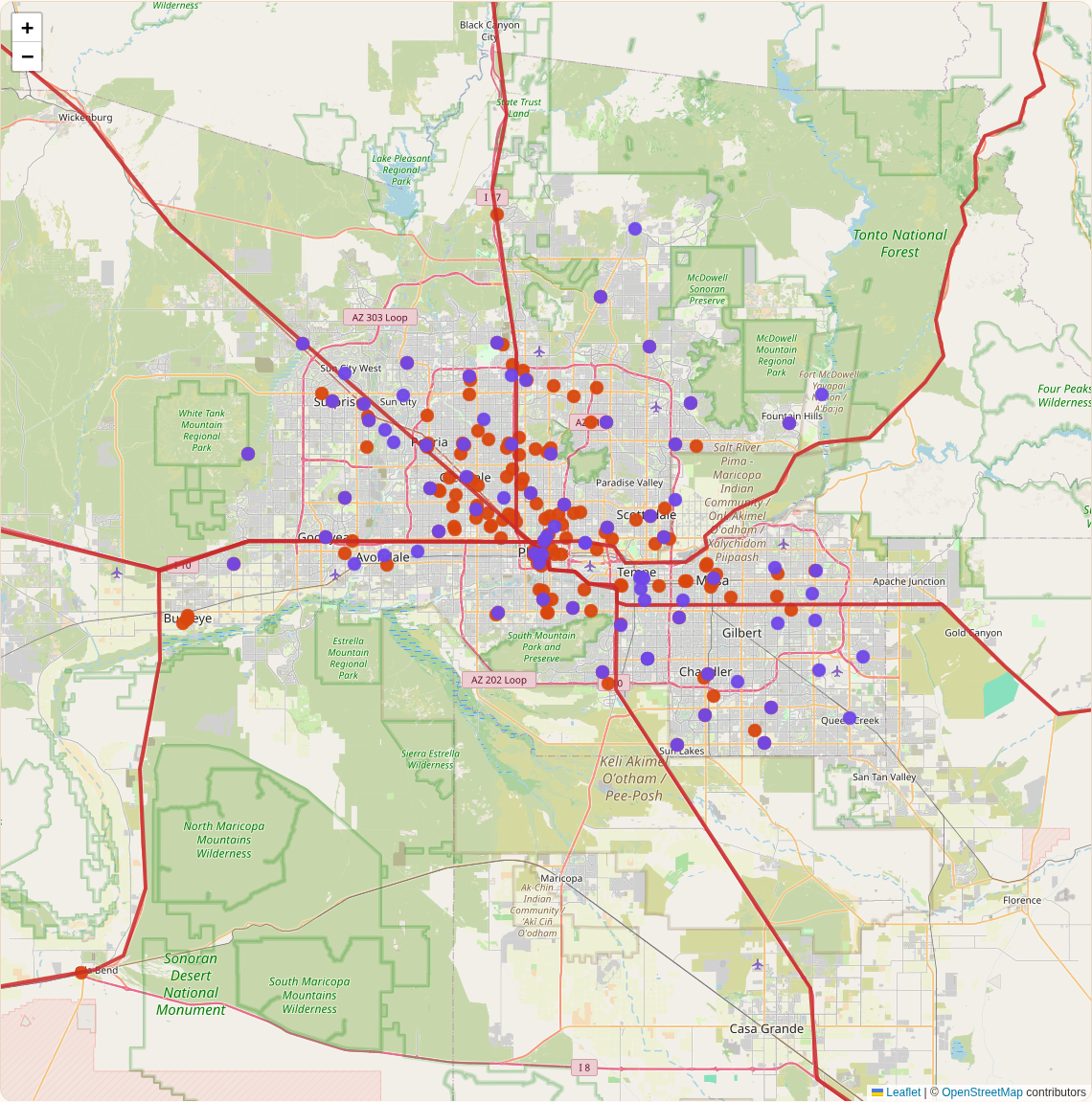
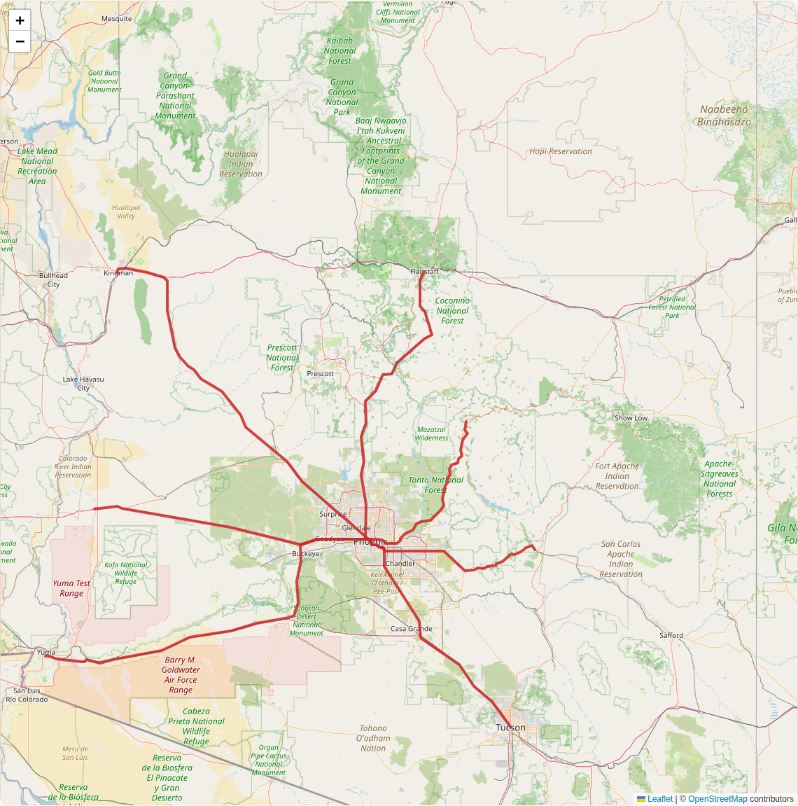
Cooling sites, water, food resources, public lands, open shelters, and evacuation routes. Curated data for the Phoenix metro and the routes to Payson and Flagstaff works offline once you've opened this page. Nationwide layers load live when you have a connection.
Read this before you use natural water or plants
- Water: many desert springs are seasonal, low-flow, or dry, and rivers below dams depend on releases. Treat all natural water. Boiling is best: a rolling boil for 1 minute, or 3 minutes above 6,500 ft. Filtering and then disinfecting is next best (CDC).
- Foraging: the "public lands" points mark habitat where native edibles (mesquite, prickly pear, saguaro, palo verde, desert ironwood) commonly grow. They are not foraging spots. Collecting is restricted or prohibited in many parks, preserves, and national monuments. Arizona's native plant law protects saguaros and many other species, and taking protected plants from public land needs a permit (ARS 3-908). Toxic plants like datura and oleander grow here too. See Bushcraft: food.
- Hunting & fishing: a state license is required and seasons apply. In Arizona, see AZGFD for hunt units and community fishing waters.
- Know what you see: the Wildlife Field Guide covers venomous animals, toxic plants, and edible species along these routes, with the laws that apply.
- Tribal lands (for example Salt River Pima-Maricopa, Fort McDowell Yavapai, Gila River, Tohono O'odham, Tonto Apache, and Yavapai-Apache) are sovereign. Hunting, fishing, gathering, and camping are off-limits without tribal permission and permits.
Offline & printable
- Open this page once while online and the site saves the Phoenix-area map data for offline use (see Save for offline). Map tiles you've already viewed may also show offline.
- We don't bulk-download map tiles: OpenStreetMap's tile policy forbids it. Instead, download our printable maps: Phoenix metro resources (PNG) · Routes to Payson & Flagstaff (PNG) · both as PDF.
- Carry a paper Arizona road map too. Phones lose signal and battery.
- Only online: FEMA open shelters, USGS public-lands shading, live nearby OpenStreetMap search outside Phoenix, and the base map for areas you haven't viewed.
Hunting & fishing: state fish and wildlife agencies (all 50 states)
Licenses, seasons, and regulations are set by each state. Tribal lands have their own rules. Links go to each agency's official site (checked Oct 10, 2026).
Show all 50 states
- Alabama: Alabama Dept. of Conservation & Natural Resources – Wildlife & Freshwater Fisheries
- Alaska: Alaska Dept. of Fish and Game
- Arizona: Arizona Game and Fish Department
- Arkansas: Arkansas Game and Fish Commission
- California: California Dept. of Fish and Wildlife
- Colorado: Colorado Parks and Wildlife
- Connecticut: Connecticut DEEP – Fishing & Hunting
- Delaware: Delaware Division of Fish and Wildlife
- Florida: Florida Fish and Wildlife Conservation Commission
- Georgia: Georgia DNR Wildlife Resources Division
- Hawaii: Hawaii DLNR Division of Forestry & Wildlife / Aquatic Resources
- Idaho: Idaho Fish and Game
- Illinois: Illinois Dept. of Natural Resources
- Indiana: Indiana DNR Fish & Wildlife
- Iowa: Iowa Dept. of Natural Resources
- Kansas: Kansas Dept. of Wildlife and Parks
- Kentucky: Kentucky Dept. of Fish & Wildlife Resources
- Louisiana: Louisiana Dept. of Wildlife and Fisheries
- Maine: Maine Dept. of Inland Fisheries and Wildlife
- Maryland: Maryland DNR
- Massachusetts: MassWildlife
- Michigan: Michigan DNR
- Minnesota: Minnesota DNR
- Mississippi: Mississippi Dept. of Wildlife, Fisheries, and Parks
- Missouri: Missouri Dept. of Conservation
- Montana: Montana Fish, Wildlife & Parks
- Nebraska: Nebraska Game and Parks Commission
- Nevada: Nevada Dept. of Wildlife
- New Hampshire: New Hampshire Fish and Game Dept.
- New Jersey: NJ Division of Fish & Wildlife
- New Mexico: New Mexico Department of Wildlife
- New York: NY State Dept. of Environmental Conservation
- North Carolina: NC Wildlife Resources Commission
- North Dakota: North Dakota Game and Fish Dept.
- Ohio: Ohio DNR Division of Wildlife
- Oklahoma: Oklahoma Dept. of Wildlife Conservation
- Oregon: Oregon Dept. of Fish and Wildlife
- Pennsylvania: Pennsylvania Game Commission (hunting); Fish & Boat Commission (fishing) · licenses / fishing
- Rhode Island: Rhode Island DEM Fish & Wildlife
- South Carolina: South Carolina DNR
- South Dakota: South Dakota Game, Fish and Parks
- Tennessee: Tennessee Wildlife Resources Agency · licenses / fishing
- Texas: Texas Parks and Wildlife Dept.
- Utah: Utah Division of Wildlife Resources
- Vermont: Vermont Fish & Wildlife Dept.
- Virginia: Virginia Dept. of Wildlife Resources
- Washington: Washington Dept. of Fish & Wildlife
- West Virginia: West Virginia DNR
- Wisconsin: Wisconsin DNR
- Wyoming: Wyoming Game and Fish Dept.
Data sources & credits
- Cooling & hydration sites (163): Maricopa Association of Governments, Heat Relief Network (HRN Public view feature service), 2026 season, downloaded Oct 10, 2026.
- Libraries (81), large parks (68), drinking fountains (441), springs (1,680), lakes (14), rivers (4), community gardens/orchards/food banks (152), Sonoran Desert public lands (24), tribal land boundaries (8): © OpenStreetMap contributors, ODbL, via the Overpass API, downloaded Oct 10, 2026. Park acreage is computed from OSM outlines.
- Evacuation routes (7): approximate geometry from OSRM routing on OpenStreetMap data. See Routes.
- Fuel & biodiesel resources (off by default): biodiesel stations (1,997 public, open B20+ stations) from the U.S. DOE Alternative Fuels Data Center station API; 83 stations tagged
fuel:biodieselin OpenStreetMap; 56 biodiesel production plants from EIA (as of Jan 1, 2024, Form EIA-819, via the EIA Energy Atlas layer); 38 Arizona farm and ag supply stores (OSMshop=agrarian/farm), plus live ag-store search nationwide. No public map exists of used cooking oil sources, so ask restaurants with UCO recycling programs. Buy, trade, or get permission. Stores may be closed or rationing in emergencies. All downloaded Oct 10, 2026. - Open shelters (live): FEMA National Shelter System, Open Shelters.
- Public & tribal lands shading (live): U.S. Geological Survey, Protected Areas Database of the United States (PAD-US) 3.0, Manager Type map service.
- Live nearby features: OpenStreetMap via the public Overpass API, loaded only when zoomed in, rate-limited and cached on your device.
- State outlines (for the agency panel): US Census-derived
us-statesGeoJSON from the Leaflet examples. Base map: © OpenStreetMap contributors. Map library: Leaflet 1.9.4 and Leaflet.markercluster 1.5.3 (BSD/MIT), self-hosted.
Back to Evacuation routes · Find your situation · After you arrive